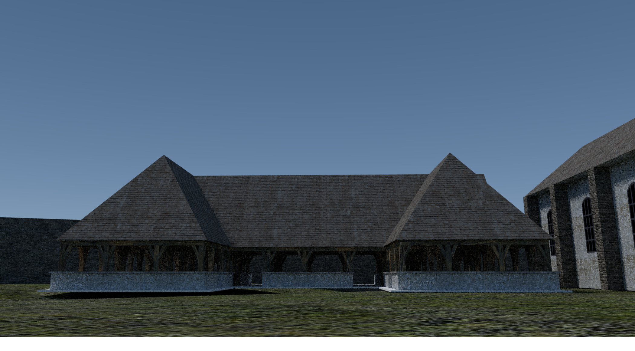
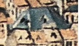
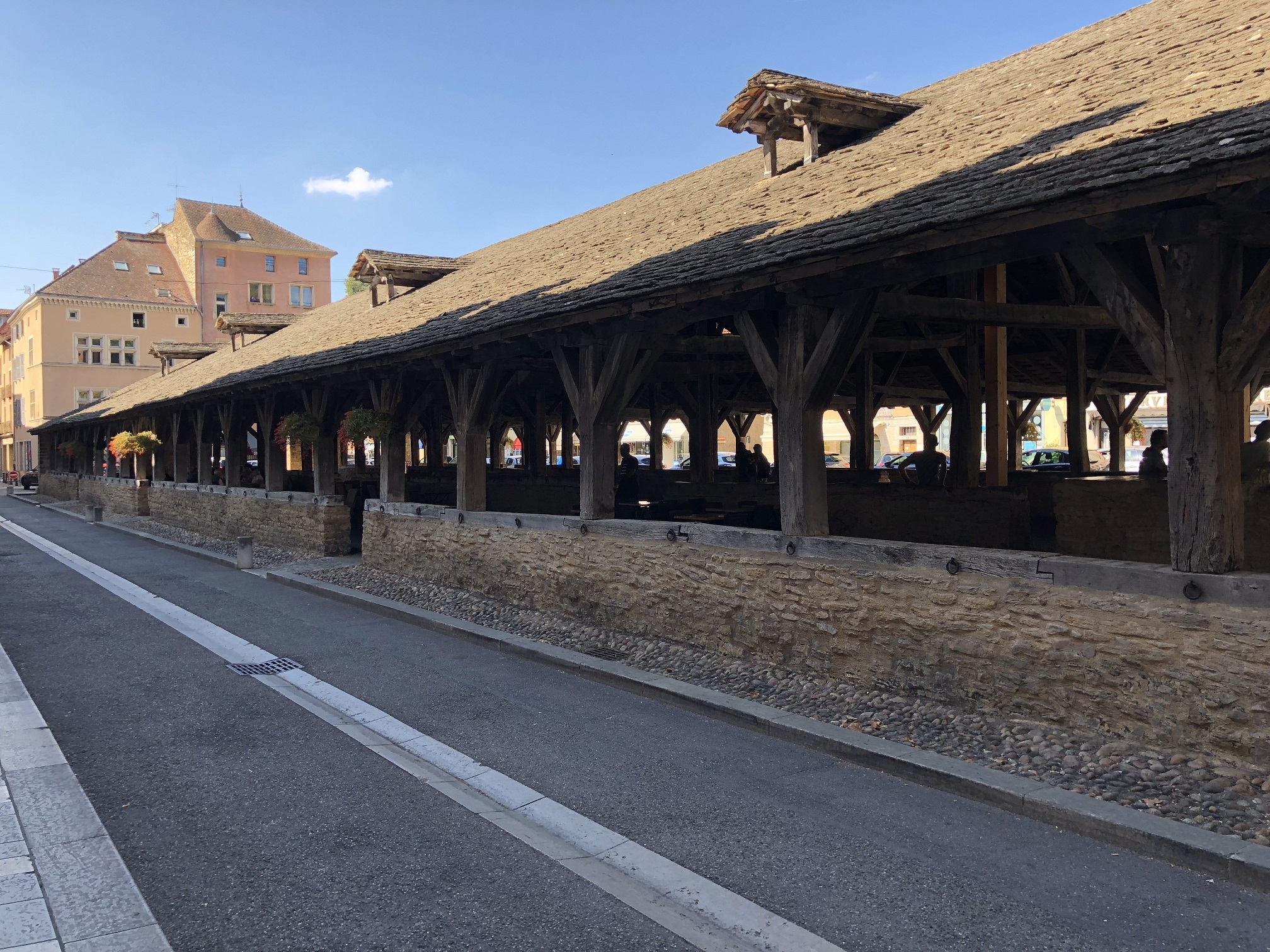
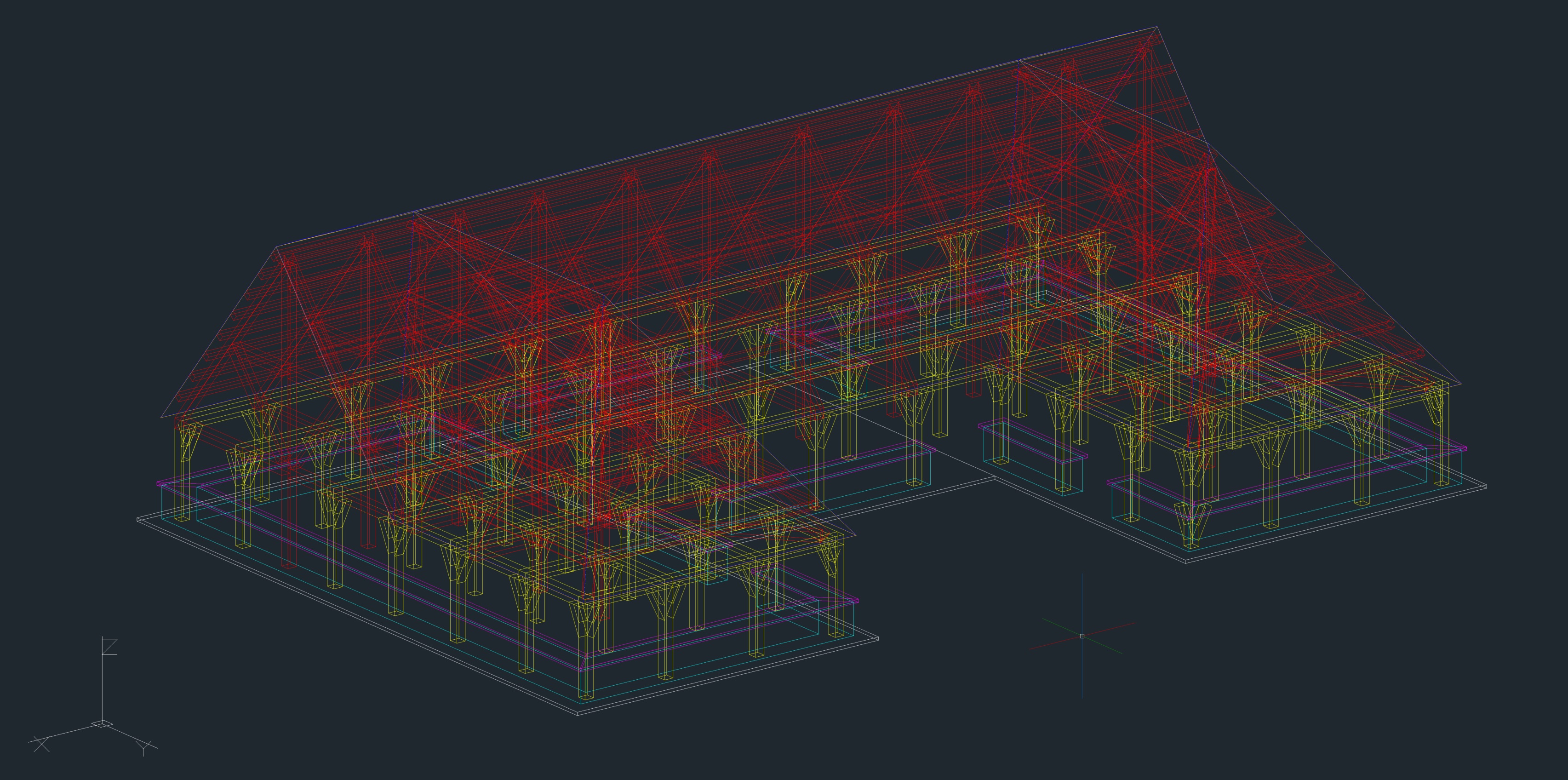
The hall was centrally located in the village. The clues left on the map of Arenberg inspire a hall of large surface with predominant roof in the architecture (bluish on the map) (Fig. 49) . These buildings looked like a large U-shaped courtyard (Fig. 51) . The central void was the public square of the time (Ref. [2]). Many halls are still standing today and we can easily imagine their configuration in the Middle Ages. Some are in an exceptional state of conservation (Milly-en-Forêt, Cremieu) and testify of all the medieval know-how (Fig. 50)
.
 |
 |
 |
| Fig.49 - The Hall 1609 Source : Arenberg Map 1609 |
Fig.50 - Crémieu - Isère Source : Photo of the author |
Fig.51 - The Hall - U-shaped configuration Source : Blender model of the author |
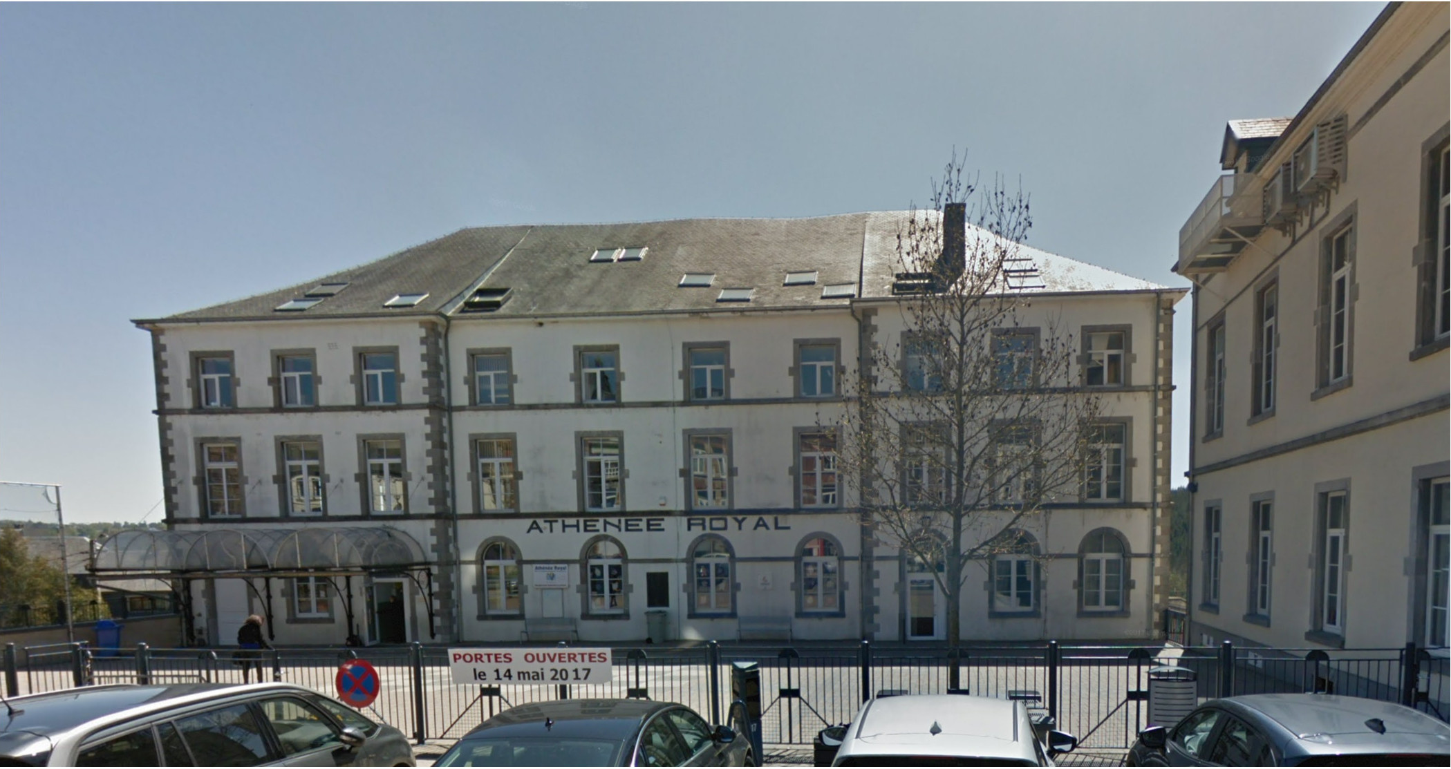
The suggested configuration is inspired by the Cremieu hall with peripheral stone walls, a completely open space and a massive frame covered with a slate roof (Fig. 50) . The location of the Hall corresponding to the Royal Athenaeum (Arsene Geubel Basic School today) and its front yard (Fig. 52) . The chapel of the village on the right was located where the town hall is located today.
(Swing the mouse "in" and "out" on the next image to see the comparison)