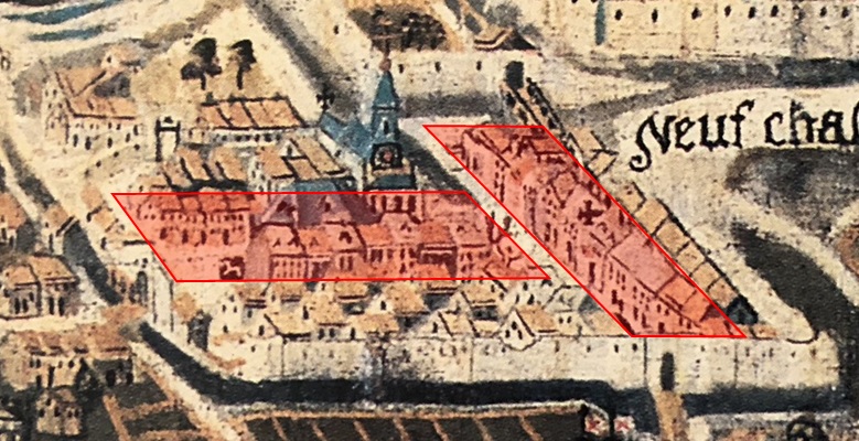
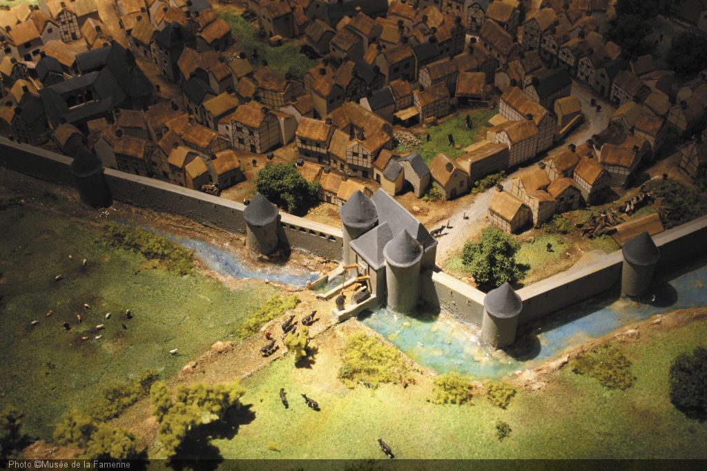
Describing the village in all its details is impossible mission. The map of Arenberg gives only a few indications on the approximate sizes of the buildings at the most. Difficult to extract the detailed architectural clue (type of masonry, roof covering, half-timbering, balustrades, etc.). An interesting element, however, is to note larger buildings along the two main axes of the town (zone indicated in red) (Fig. 57) : that connecting the center to the Saint Roch gate to the north and the other connecting the center and Longlier gate to the east. These two main axes remained today: Lucien Burnotte and Franklin Roosevelt Streets. The rest of the town dwellings are smaller in size. This remark will guide the outline for the reconstitution of the town. Along the main axes we will model houses supposedly bourgeois and more affluent (with two floors in view of the 3 levels of bays that can be seen on the map of Arenberg) while the rest will be inspired by a work done for the model "Marche 1600" with houses much more modest (visit to the FAM museum in Marche-en-Famenne that I highly recommend!) (Fig. 58) and which is probably very close to the appearance of the village of Neufchâteau at the same time. We will also respect the number and layout of the "intramural" buildings listed on the Arenberg map.
 |
 |
 |
| Fig.60 - The town Source : Arenberg Map 1609 |
Fig.61 - Marche-en-Famenne 1600 Source : FAM - Marche-en-Famenne |
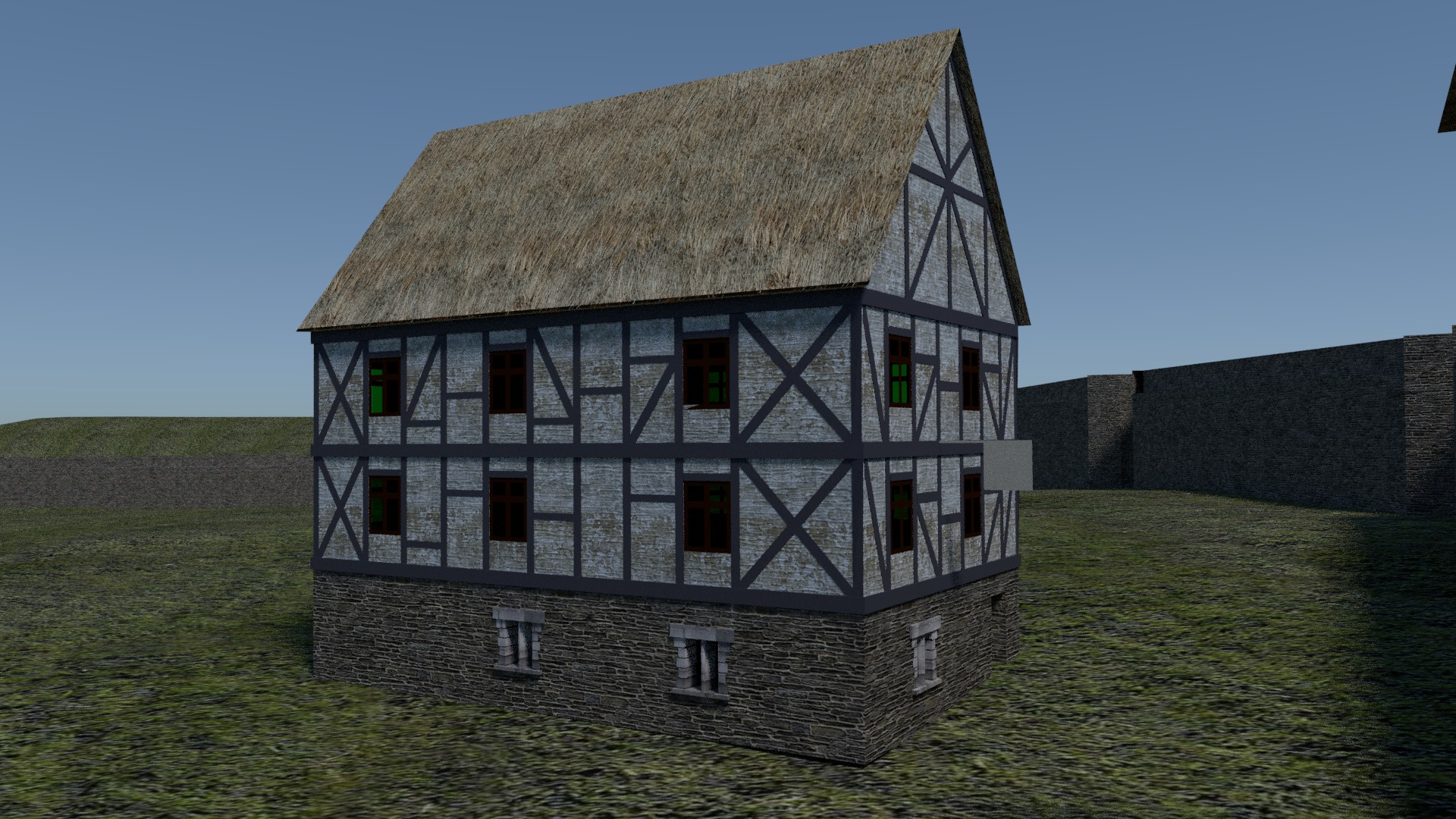
Fig.62 - Medieval house: an example Source : Blender 3D model of the author |
For the architecture of the houses, we will follow some great principles (Fig. 59) :
- Underlayment in hard masonry (exposed stone or lime)
- Floor with half-timbered frame and cob walls.
- Roofs of different varieties (thatch, wood, slates)
These details are not noticeable on the map of Arenberg but the panoply of colors suggests the varied use of these different elements.
A first aerial view gives us an idea of the town as a whole (Fig. 60) .
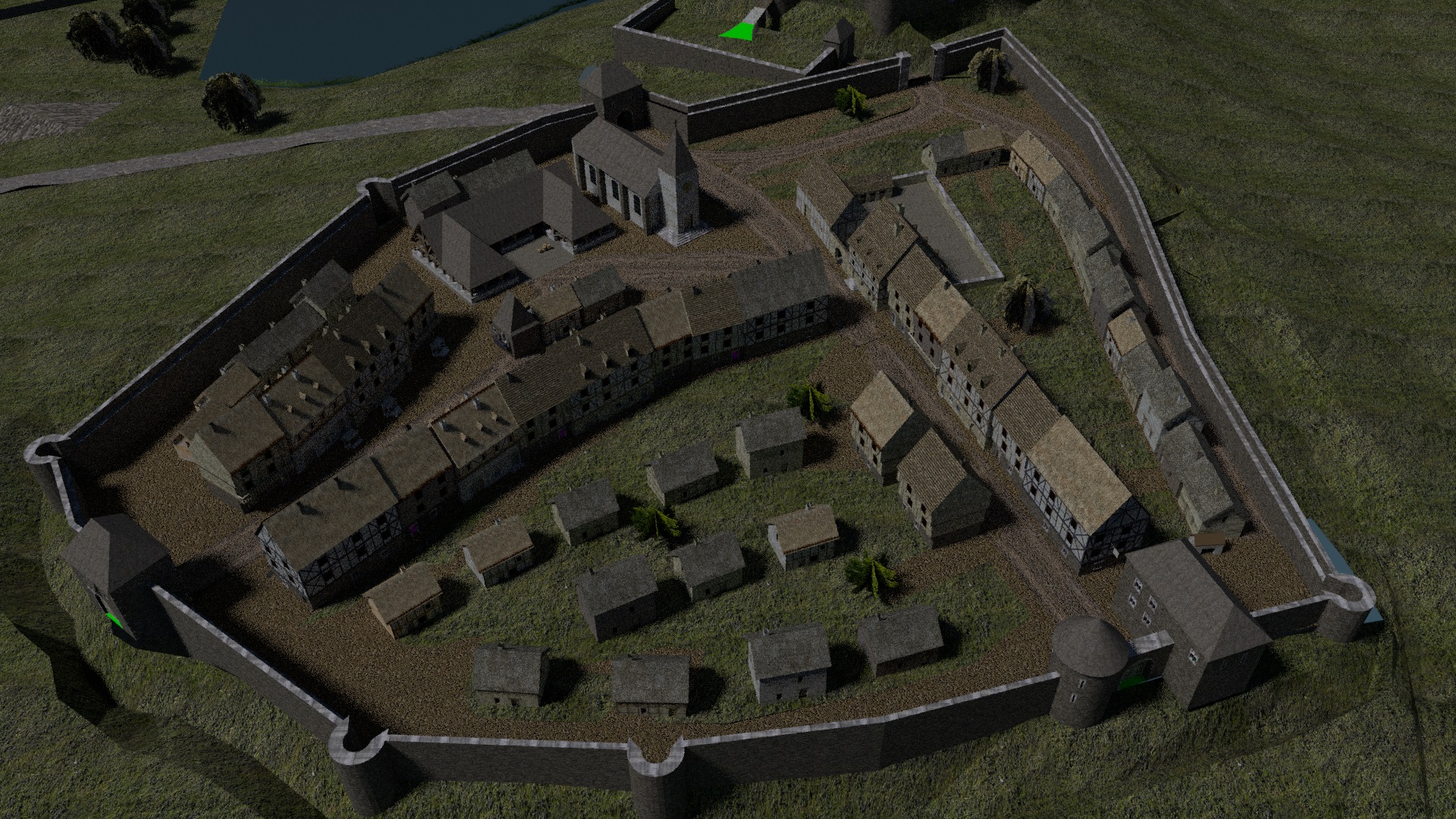 |
| Fig.63 - The town in the Middle Ages - Aerial view Source : Blender 3D model of the author |
The number of buildings attached to the intramural surface suggests a more airy implentation than that painted in 1609. The density on the map of Arenberg is misleading. The buildings are over-sized in relation to the available space. This suggests two major commercial arteries similar to the city's configuration today belts with smaller houses probably surrounded by pens for the small breeding. Pure hypothesis according to the space available.
Today's Grand Place was already the center of all the commercial activity with its hall and the adjoining inns ("Au Mouton blanc", "Grand Cerf"). The townhouse and adjoining buildings in the middle of the square are left here as a reference. Nothing is less certain about their presence in the Middle Ages for the period that concerns us (around the fourteenth and fifteenth century). The town house is referenced mid-seventeenth century in some works.
Always instructive is the comparative view between the Middle Ages and the city today. The similarities in the implementation is very great. No more medieval buildings survive, but the general intramural configuration has not changed much with the newer buildings that replaced them. To be convinced we give here some comparisons in different points of the city.
(Roll the mouse "in" and "out" on the following images to see the comparison)


Fig.64 - Grand Place


Fig.65 - Franklin Roosevelt street


Fig.66 - Lucien Burnotte street